Geospatial Network Inventory
Network inventory software based on QGIS and FreeCAD
Geospatial Network Inventory (GNI) is a system of geospatial inventory of telecom resources intended for the operators who construct, develop, and maintain their network infrastructure. The solution provides a set of functionalities for the network elements inventory and processing. In conjunction with the product Ksavi Network Operations it enables the execution of operator’s processes related to the network infrastructure management, among others, such as development, cost estimation, service delivery, maintenance, infrastructure leases.
The application architecture is based on the QGIS geospatial platform and FreeCAD system. Thanks to the comprehensive GIS and CAD interfaces and using a great potential of those environments, we have created a product that fully meets the requirements of a modern telecom operator. A central database enables storing information about any network element. A set of standard QGIS plugins in conjunction with dedicated components created for the TELECO sector provides easy management of the network in any state and the execution of the reporting requirements imposed by the regulatory authorities.

Using the license rules for distribution of the QGIS platform in force, our Geospatial Network Inventory software is offered in a completely free version, as well as a commercial solution. This allows you to become familiar with its environment and successfully use the system with planning functionalities provided in the free version (GNI FREE). You can expand your system at any time with additionally paid modules according to your specific requirements.
A description of the applications of the free and the commercial versions is shown on individual pages describing the use of the product for different solutions in the TELECO sector.
Advantages of using GIS and CAD open platforms

The choice of QGIS as a GIS platform
QGIS

The choice of FreeCAD as a CAD platform
FreeCAD
Product features
QGIS distribution
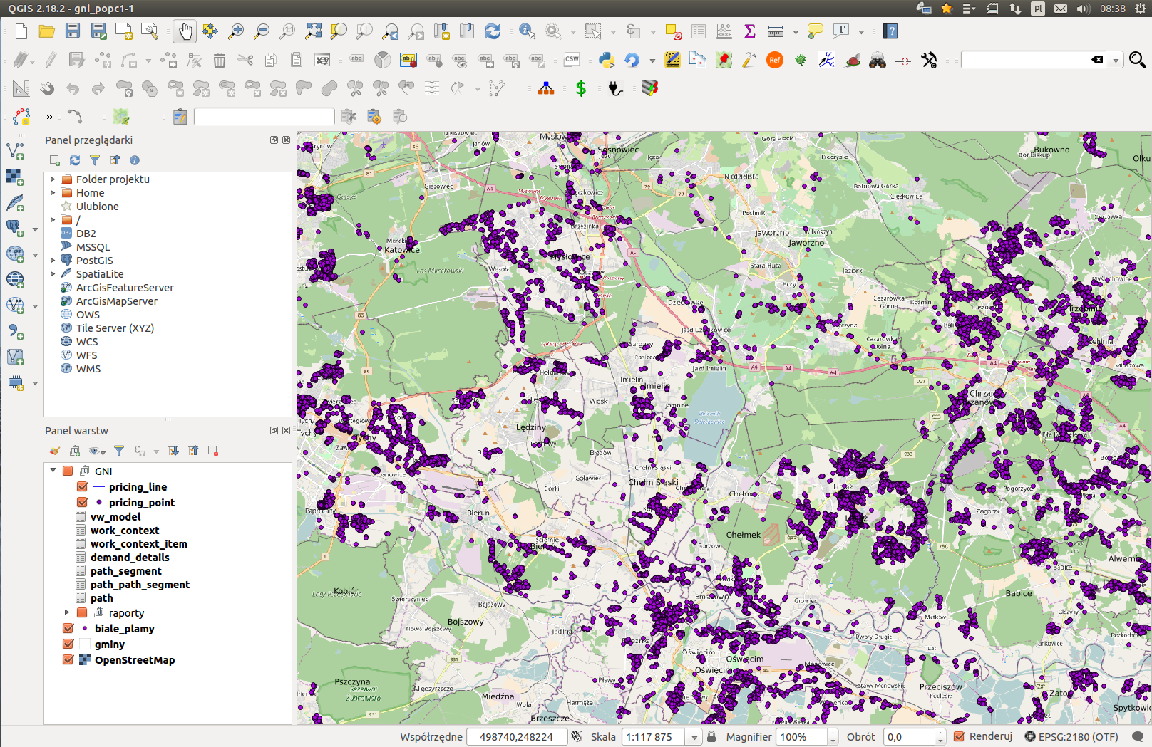
Geospatial Network Inventory software is based on a standard QGIS system distribution available on the http://www.qgis.org. Our product enriches the selected version of QGIS with:
FREE
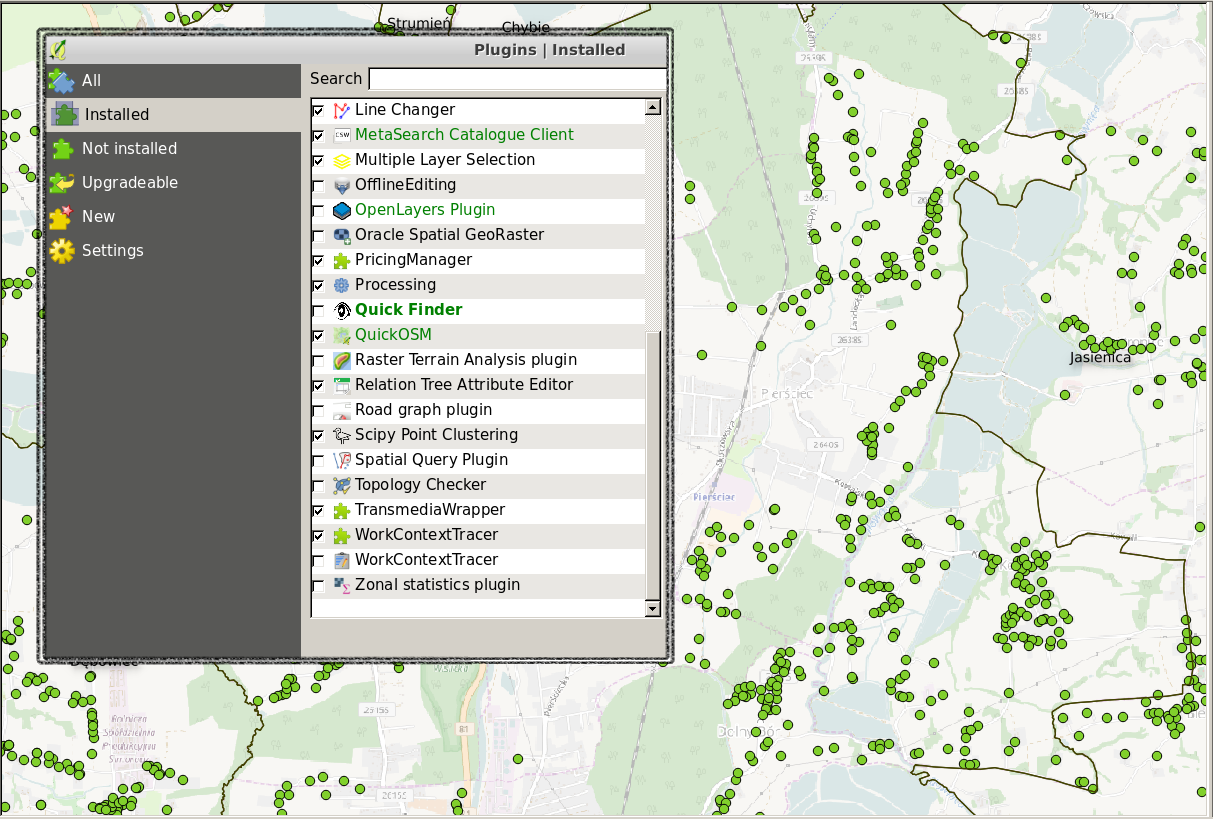
QGIS plugins
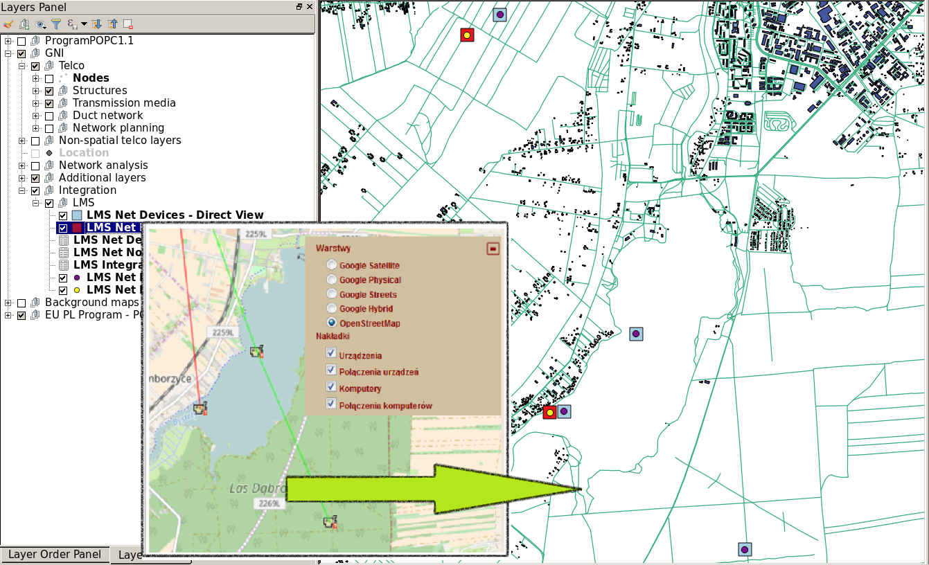
Standard installation of QGIS is enhanced with the set of plugins selected from the publicly available repository. Distribution of the Geospatial Network Inventory tool is additionally supplemented by our own plugins that provide functionalities specific for the processes realized on a telecommunication network.
The plugins that require additional data layer to work complement the QGIS configuration with necessary relations, forms and definition of map symbols.
FREE
Telco Outside Plant Model
The data model enabling an inventory of outside plant telecommunication resources. Model embedded in the geospatial database delivers high performance of operation on the layers with large volumes of data. The module allows you to create the inventory of network elements such as:
Supplied data model is enhanced with a standard QGIS configuration in the scope of layers definition, their symbology, detailed forms of objects and relations between them:
license
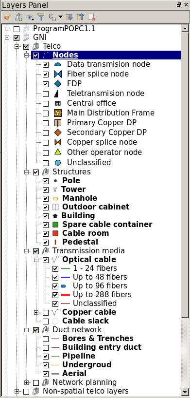
Telco Outside Plant Modules
The Telco Outside Plant data model is enhanced with additional modules with respective additional layers complementing the functionalities of QGIS platform to use in TELCO domain:
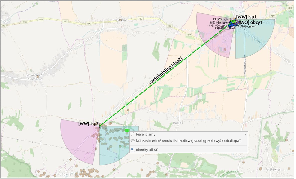
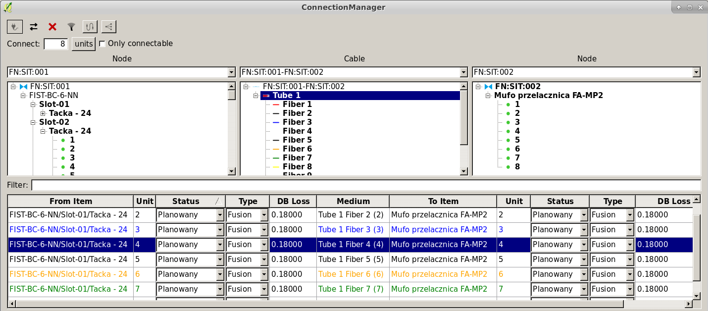
Connection Manager – A module for managing the connections between the elements of the transmission medium and ports of the devices on which the cable is terminated. It allows you to store splices and pluggable connections between the network devices both on the outside and inside plant networks.
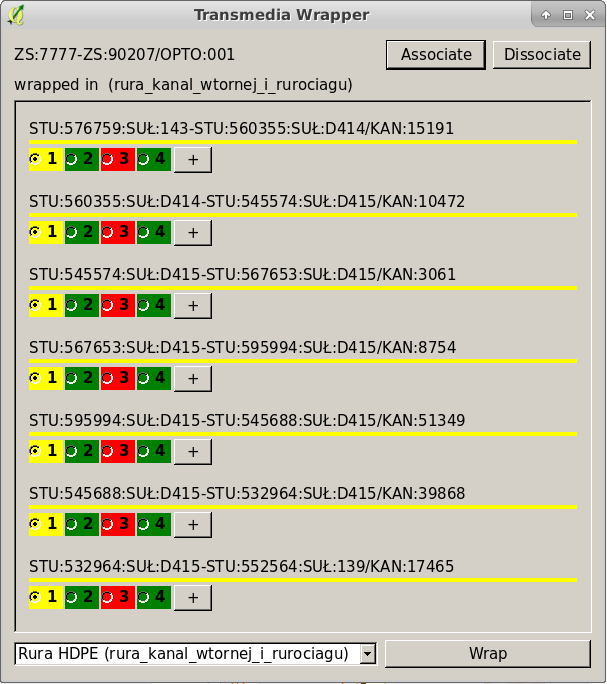
Duct & Cable Placer – a dedicated component introducing to the geospatial inventory of cables and ducts elements related to their internal organisation allowing, among others, the detailing of duct network with main conduits, subducts and microducts and also automation of blowing and pulling cables.
Schema Generator – a module used to visualize the network state in the form of schematic drawings. It allows, among others, generation of fibre splicing schematic with fibre colours, allocations and terminations in splice closures and other nodes of optical network.
Path analyser – additional layers and components related to searching for the available optical paths and their analysis thereof, among others, in terms of attenuation balance.
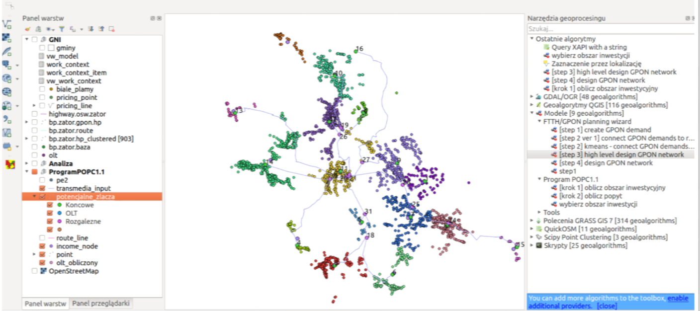
Network planner – A set of plugins and algorithms for performing the technical concept of the planned FTTH/GPON network. The component is part of the free version of GNI system.
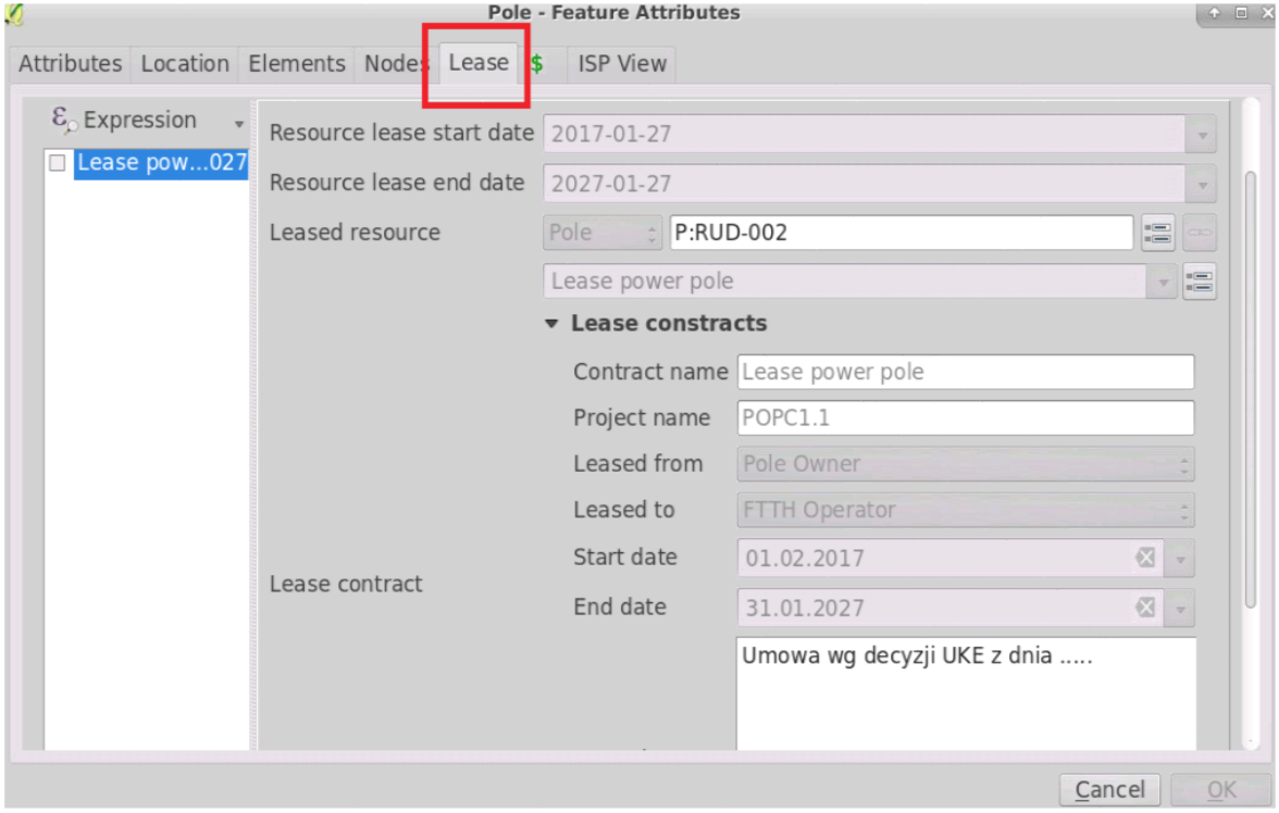
Lease contracts – An addition to the data model used for keeping information of lease contracts and their connections with leased infrastructure components.
license
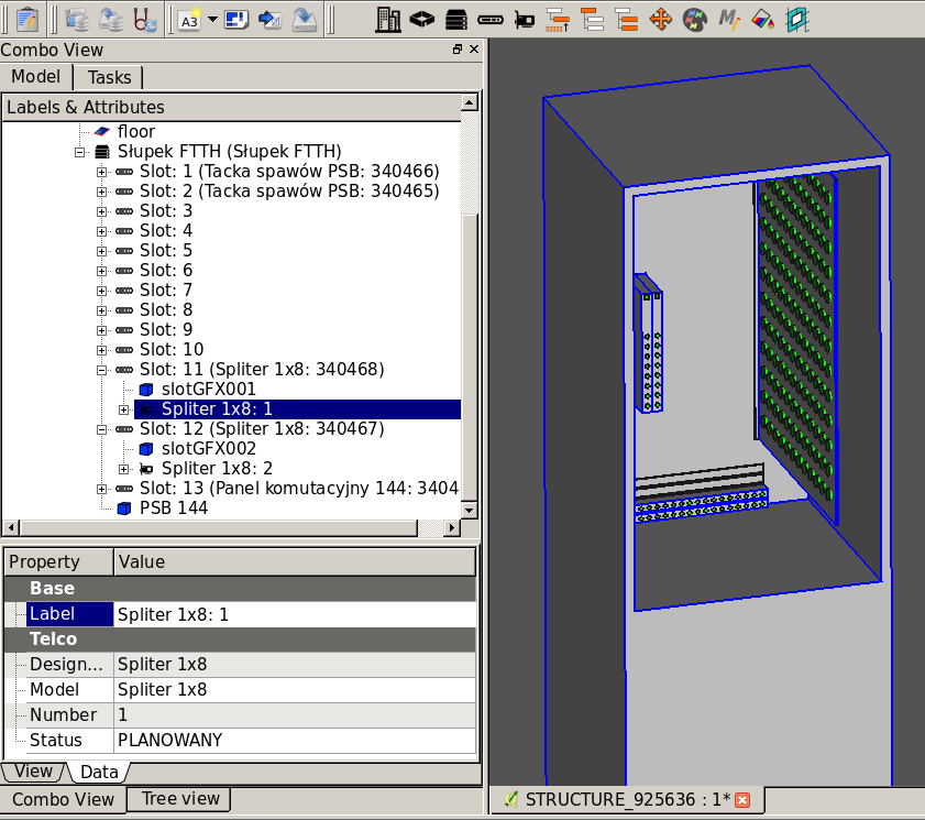
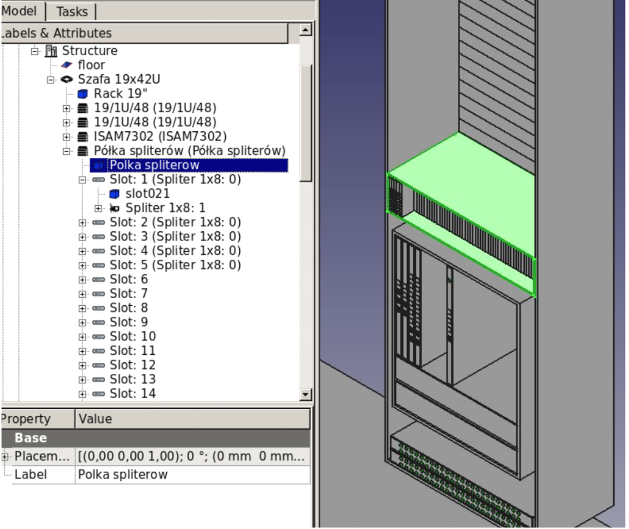
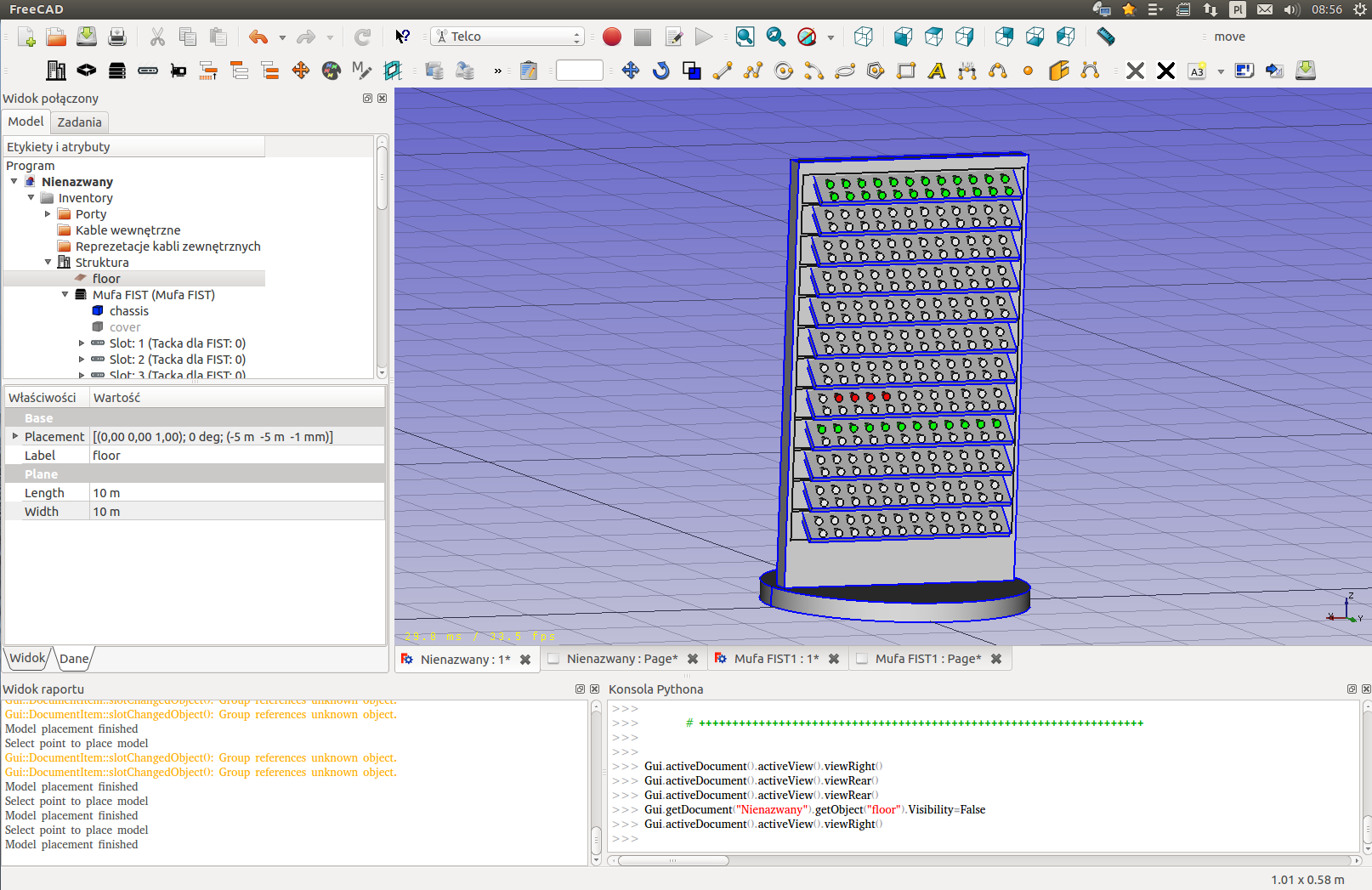
Telco Inside Plant Model
A module of inside plant telecommunication resources inventory. Provides a flexible data model allowing for storage of the network elements such as:
license
Telco Inside Plant Modules
Together with the Telco Inside Plant data model a CAD tool for designing, visualising and managing network elements is delivered, of which the main features are:
license
Document generation
Using the standard QGIS functionality, a set of publicly available plugins and dedicated Geospatial Network Inventory modules allow the generation of documents that are elements of the design, executive and as-built documentation. A list of documents that may be generated from the system includes:
license
Integration
The proposed solution has extended possibilities of integration with other IT systems regardless of whether the software works in the cloud or is installed on customer premises. The database engine used in the server version gives great opportunities for the use of multiple proven integration technologies.
license