FTTH network planning & FTTH network design software based on QGIS and FreeCAD
The European Digital Agenda, developed by the European Commission, assumes in its program, inter alia, a provision of access to high-speed Internet for the citizens of Europe. This imposed on individual Member States of the European Union an obligation to provide the access to broadband connection for every household by 2020. Owing to this initiative and financial support of the EU funds many local operators have received a chance to develop their network on which they will be able to provide new services.
Meeting the needs of telecommunication entrepreneurs, we offer a software that is designed to support their activities both at the stage of their FTTX / FTTH network planning, as well as during further works related to full preparation of investments, implementation and subsequent maintenance thereof.
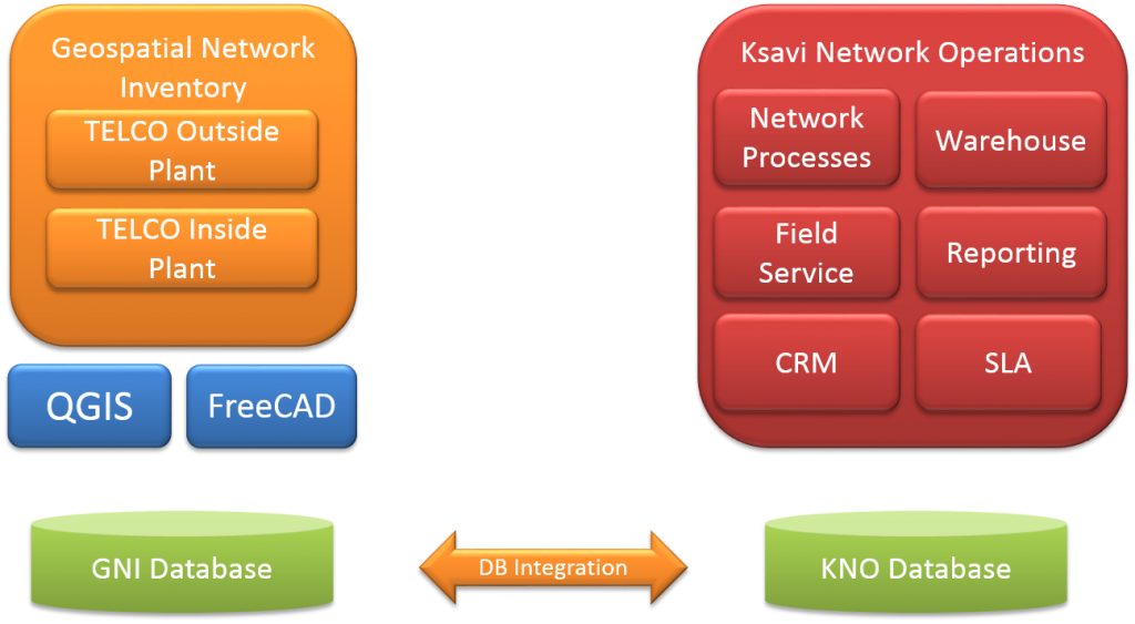
Overall solutions consist of two products Geospatial Network Inventory and Ksavi Network Operations offering full features of a professional inventory system and network operation support services. Using free and open-source GIS (QGIS) and CAD (FreeCAD) software we developed a solution that while maintaining its functionality, will compete in price with other commercial products of this class.
Fully featured fiber design tool for telecom operators

Geospatial Network Inventory
Geospatial Network Inventory FREE
Ksavi Network Operations
Meet advantages of open-source based solution
Operational benefits
Work on geospatial outside plant network elements using a natural way of working with QGIS
Work on spatial inside plant network elements using a natural way of working with CAD
Ability to use address data, existing network elements and devices, road networks, backgrounds from publicly available systems
Ability to customize the platform to suit one’s own needs using publicly developed and available plugins
Business benefits
Lack of licence fees related to operating systems, database engines, GIS/CAD libraries
Financial security from the use of the system over a long period of time
Vendor lock-in independency and ability for system enhancement at one’s own
Wide access to forums, trainings, and professional companies providing support, maintenance and development of the QGIS platform


